
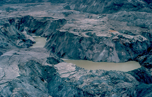
The explosion of Mount St. Helens 30 years ago, this Tuesday, produced a blast that spread for some 19 miles. The blast traveled at the speed of sound, mowing down thousands of acres of forest and showering the area with hot ash and gases.
The U.S. Geological Survey, DNR, other agencies, researchers, and emergency officials keep tabs on all five of the active volcanos in Washington state. See our Mount St. Helens information page with information and many links about volcanoes. Here is an article from this month’s National Geographic about this event.
QUESTION: Who renamed Mount St. Helens to replace the Native American name and who did he honor with the new name?
See the answer on tomorrow’s Ear to the Ground …or… see the answer now on DNR’s Facebook page (while you’re there, please let us know if you like it, and “fan us” — we’ve got plenty more information about Mount St. Helens coming in the next few days.)
Yesterday’s QUIZ: Q: What is a Native American name for Mount St. Helens and what does it mean? A: ‘Louwala-Clough’ (smoking mountain), according to the USGS http://vulcan.wr.usgs.gov/LivingWith/Historical/volcano_names.html . Some tribal legends call it ‘Loo-wit’
See more photos of Mount St. Helens before and after the May 18, 1980, eruption on DNR’s Flickr page.
 |
 |
 |
 |
 |
 |
